Файл:Inundaciones en Argentina Argentina.A2003128.1420.721.250m.jpg

Исходный файл (4000 × 5200 пкс, размер файла: 4,47 Мб, MIME-тип: image/jpeg)
Этот файл находится на Викискладе. Сведения о нём показаны ниже.
Викисклад — централизованное хранилище для свободных файлов, используемых в проектах Викимедиа.
|
Краткое описание
| Описание |
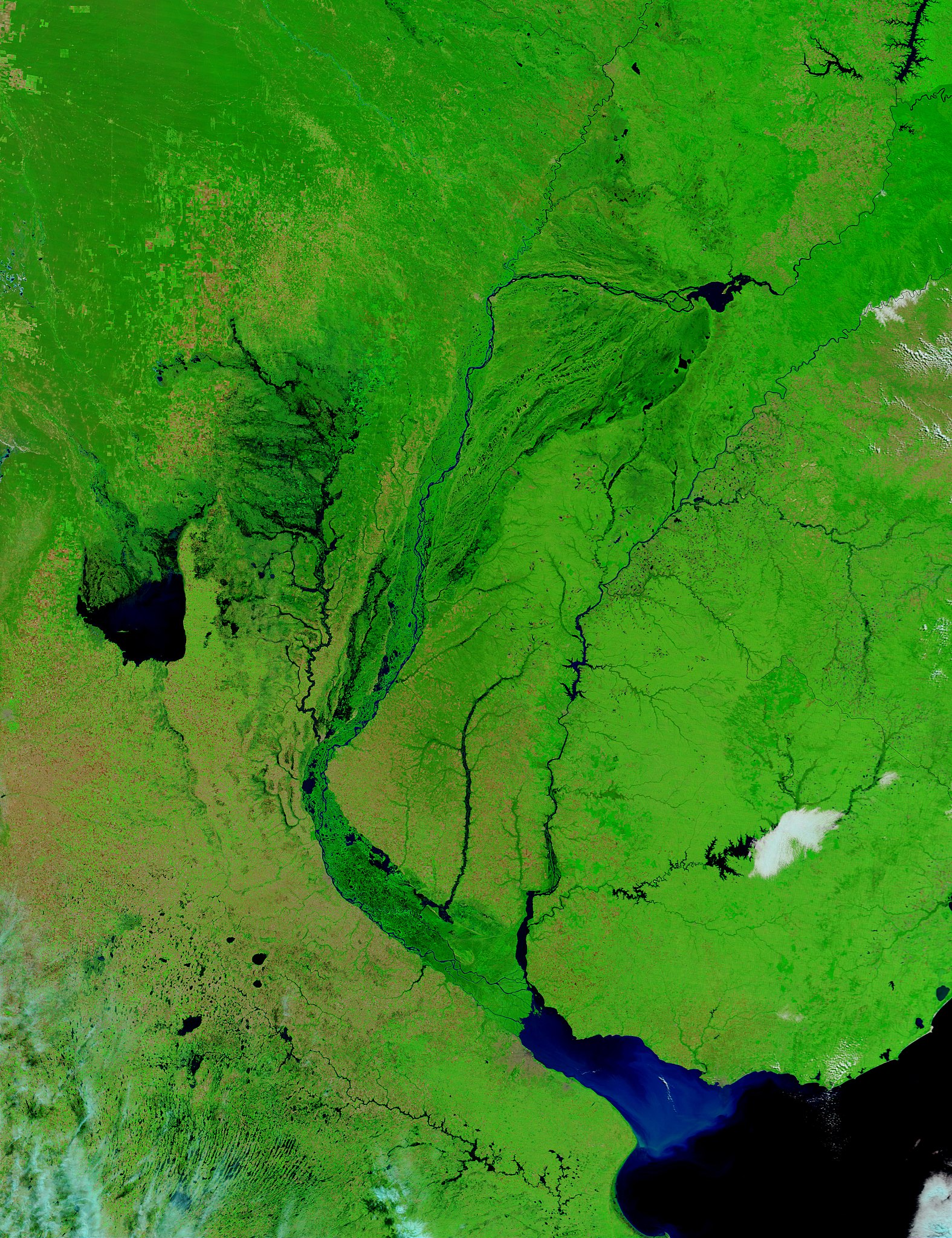
Descripción original (NASA): Flooding around Central Argentina’s lakes and rivers can be seen in these Terra MODIS images acquired on May 8, 2003. Fifty-five inches of rain fell in two days, where normally only 32 inches fall all year. Flowing down the center of the image is the Parana River, the second largest river system in South America. Its tributaries experienced flooding toward the lower middle of the image where the Parana makes a great bend eastward toward the Rio de la Plata and the Atlantic Ocean. Running south to meet the Parana near that point is the Salado River, which burst its banks for far more pronounced flooding, as can be noted by the inky-black stains on the land surrounding it (in the false-color image, standing water is dark blue or black). To the Salado’s left is the Lago Mar Chiquita, which appears to have doubled in size. Farther southeast, before where the Parana and the Uruguay Rivers meet to empty into the Rio de la Plata, the Gualeguay River has widened considerably as well. These floods caused the deaths of at least 24 people, left hundreds missing, and cost hundreds of millions of pesos in damage to farms and crops. Seventy thousand people were evacuated from their homes in the Santa Fe province, and many were left without food, electricity, or drinkable water. Santa Fe province is one of the richest provinces for agriculture and livestock production, and the floods covered one third of the land (including 2/3 of the cattle-ranching lands). In the false-color image, water appears black or dark blue, land appears bright green and orange, and clouds appear white or light blue. |
| Дата | |
| Источник | http://visibleearth.nasa.gov/view_rec.php?id=7007 |
| Автор | NASA |
| Другие версии |
.jpg)
Лицензирование
| Этот файл находится в общественном достоянии (англ. public domain), так как он был создан NASA (Национальным управлением по аэронавтике и исследованию космического пространства). Политика авторского права NASA гласит, что «Материал NASA не защищается авторским правом, если не указано иное». (См. Template:PD-USGov, страницу политики авторского права NASA или политику использования изображений JPL.) | ||
 |
Предупреждения:
|
История файла
Нажмите на дату/время, чтобы посмотреть файл, который был загружен в тот момент.
| Дата/время | Миниатюра | Размеры | Участник | Примечание | |
|---|---|---|---|---|---|
| текущий | 15:46, 19 ноября 2007 | | 4000 × 5200 (4,47 Мб) | Tano4595 | {{Information |Description= Descripción original (NASA): '' Flooding around Central Argentina’s lakes and rivers can be seen in these Terra MODIS images acquired on May 8, 2003. Fifty-five inches of rain fell in two days, where normally only 32 inches |
Использование файла
Следующие 2 страницы используют этот файл:
Глобальное использование файла
Данный файл используется в следующих вики:
- Использование в af.wikipedia.org
- Использование в ast.wikipedia.org
- Использование в en.wikibooks.org
- Использование в es.wikipedia.org
- Использование в fr.wikipedia.org
- Использование в lij.wikipedia.org
- Использование в pt.wikipedia.org
- Использование в www.wikidata.org