Файл:NepalBajuraDistrictmap.png
Исходный файл (2479 × 3508 пкс, размер файла: 249 КБ, MIME-тип: image/png)
Этот файл находится на Викискладе. Сведения о нём показаны ниже.
Викисклад — централизованное хранилище для свободных файлов, используемых в проектах Викимедиа.
|
| Описание |
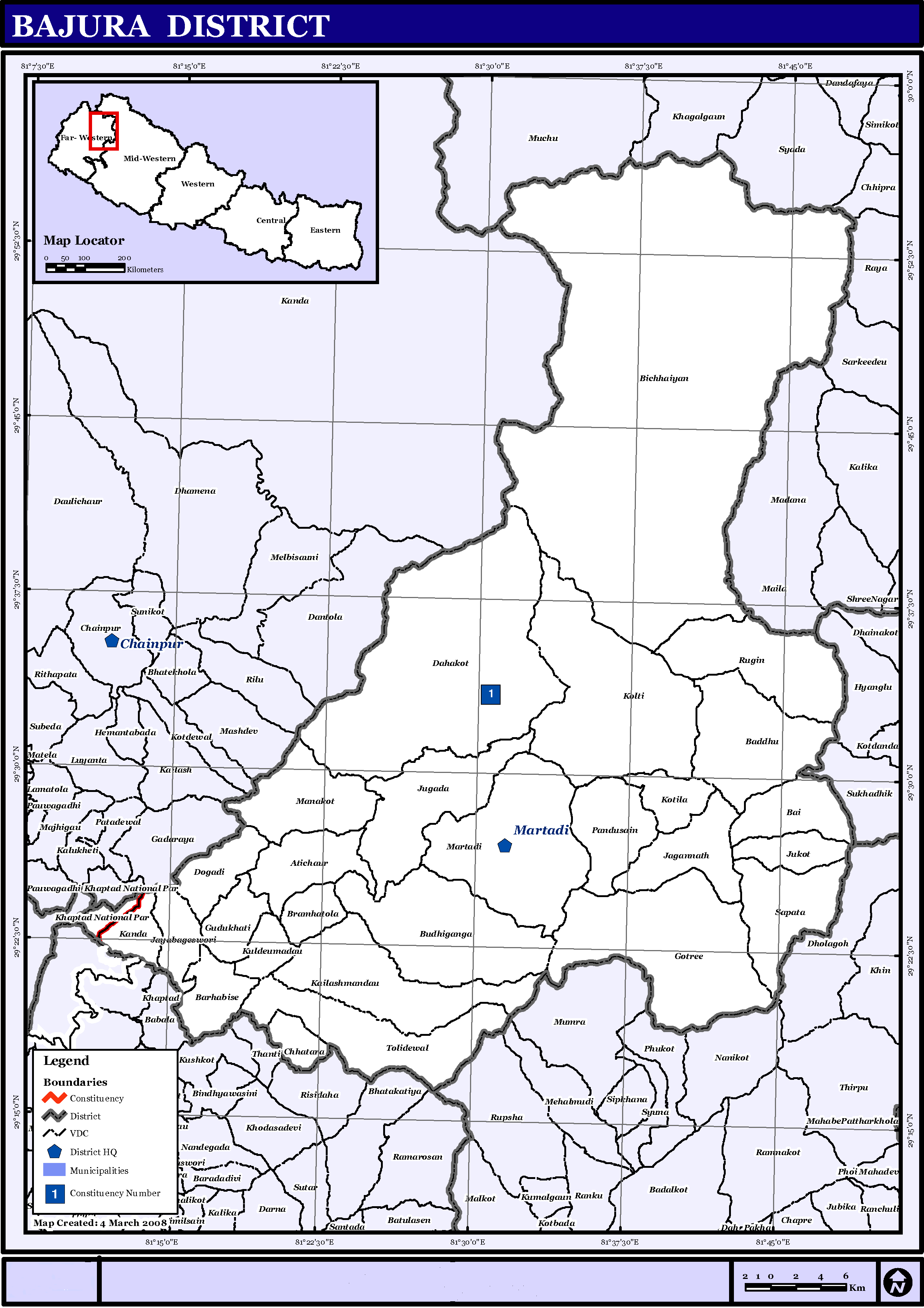
English: Map displaying Village Development Committees in Bajura District, Nepal |
|||
| Дата | ||||
| Источник | http://www.un.org.np/maps/district-maps/far-western/Bajura.pdf | |||
| Автор | United Nations | |||
| Права (Повторное использование этого файла) |
|

История файла
Нажмите на дату/время, чтобы посмотреть файл, который был загружен в тот момент.
| Дата/время | Миниатюра | Размеры | Участник | Примечание | |
|---|---|---|---|---|---|
| текущий | 15:21, 21 мая 2016 | | 2479 × 3508 (249 КБ) | Timeshifter | Removed UN logo and info. Only UN maps without UN info are allowed. |
| 01:40, 6 ноября 2008 |  | 2479 × 3508 (272 КБ) | Sadalmelik | {{Information |Description={{en|1=Map displaying Village Development Committees in Bajura District, Nepal}} |Source=http://www.un.org.np/maps/district-maps/far-western/Bajura.pdf |Date=March 4, 2008 |Author=United Nations |Permission={{PD-UN}} |other_ |
Использование файла
Следующая страница использует этот файл:
Глобальное использование файла
Данный файл используется в следующих вики:
- Использование в de.wikipedia.org
- Использование в en.wikipedia.org
- Использование в fi.wikipedia.org
- Использование в it.wikipedia.org
- Использование в mai.wikipedia.org
- Использование в ms.wikipedia.org
- Использование в ne.wikipedia.org
Просмотреть глобальное использование этого файла.