Файл:Willem Blaeu - Tabula Magellanica 1635.jpg
Размер этого предпросмотра: 774 × 600 пкс. Другие разрешения: 310 × 240 пкс | 619 × 480 пкс | 991 × 768 пкс | 1280 × 992 пкс | 2037 × 1579 пкс.
Исходный файл (2037 × 1579 пкс, размер файла: 3,2 МБ, MIME-тип: image/jpeg)
Этот файл находится на Викискладе. Сведения о нём показаны ниже.
Викисклад — централизованное хранилище для свободных файлов, используемых в проектах Викимедиа.
|
Краткое описание
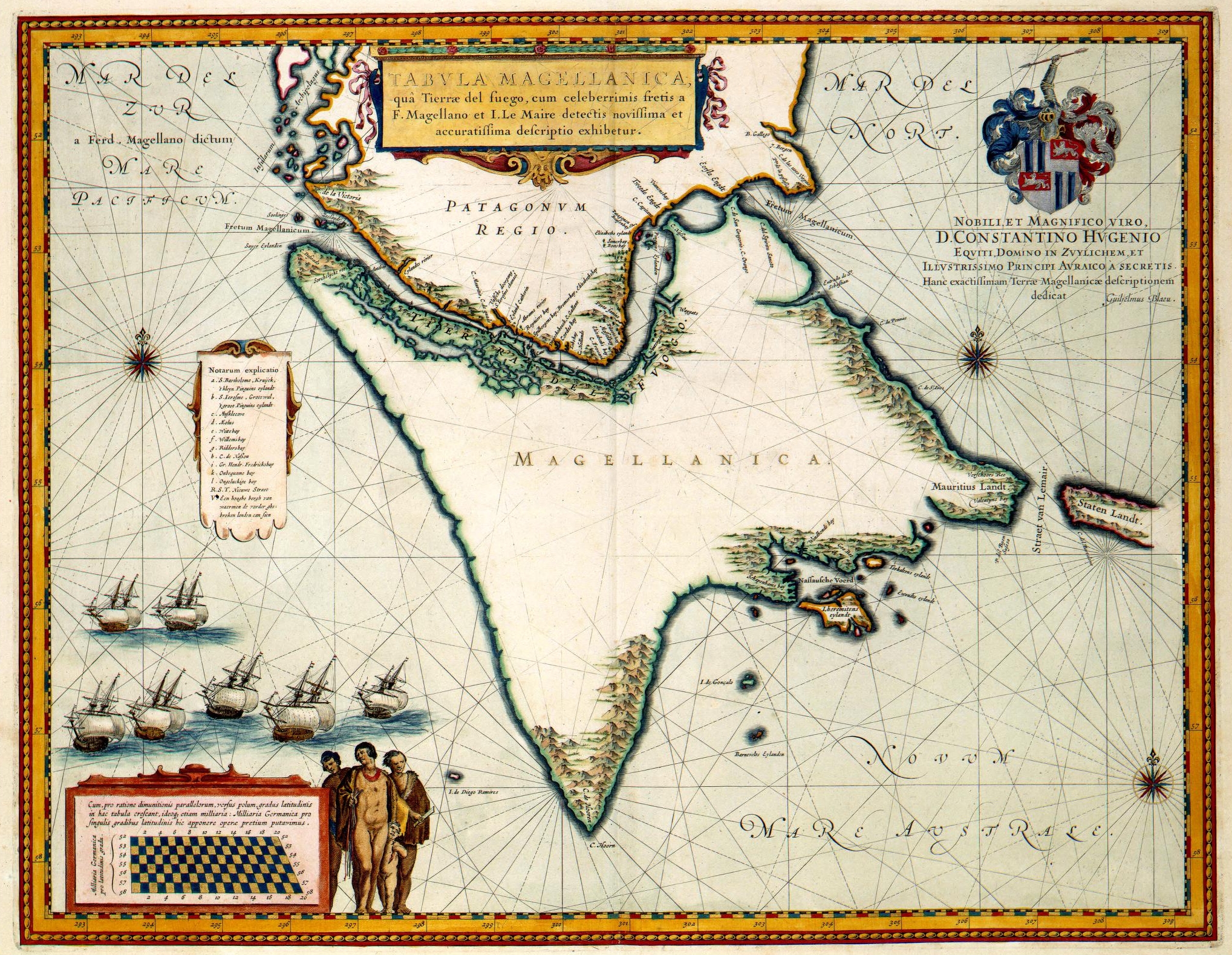
| Описание |
"Tabula Magellanica" (1635).
|
||||||||||||||||||||||||||
| Дата | |||||||||||||||||||||||||||
| Источник | Het geheugen van Nederland | ||||||||||||||||||||||||||
| Автор |
|
||||||||||||||||||||||||||
| Права (Повторное использование этого файла) |
PD-old | ||||||||||||||||||||||||||

Лицензирование
|
Это произведение находится в общественном достоянии в тех странах, где срок охраны авторского права равен жизни автора плюс 100 лет и менее. | |
| Этот файл был определён как свободный от известных ограничений авторского права, а также связанных и смежных прав. | |
This digital media file - and/or the physical objects depicted on it - originates from the digital and/or physical collections of the Koninklijke Bibliotheek, national library of the Netherlands.
|
| Аннотации | Это изображение аннотировано: Просмотреть аннотации на Викискладе |
История файла
Нажмите на дату/время, чтобы посмотреть файл, который был загружен в тот момент.
| Дата/время | Миниатюра | Размеры | Участник | Примечание | |
|---|---|---|---|---|---|
| текущий | 07:42, 22 июня 2006 | | 2037 × 1579 (3,2 МБ) | Jan Arkesteijn | {{Information |Description=Willem Blaeu: Tabula Magellanica |Source=[http://www.geheugenvannederland.nl/gvn/search/titelpresentatie.xsp?recordid=439&onlineid=KONB01_1049B13_090&dbcode=KONB01 Het geheugen van Nederland |Date=1635 |Author=Willem Blaeu |Per |
Использование файла
Следующая страница использует этот файл:
Глобальное использование файла
Данный файл используется в следующих вики:
- Использование в ast.wikipedia.org
- Использование в bg.wikipedia.org
- Использование в ca.wikipedia.org
- Использование в es.wikipedia.org
- Использование в fr.wikipedia.org
- Использование в hy.wikipedia.org
- Использование в it.wikipedia.org
- Использование в nl.wikipedia.org
- Использование в pt.wikipedia.org
- Использование в uk.wikipedia.org