Файл:Earth 720Ma.gif

Размер этого предпросмотра: 800 × 450 пкс. Другие разрешения: 320 × 180 пкс | 640 × 360 пкс | 1024 × 576 пкс | 1280 × 720 пкс | 1920 × 1080 пкс.
Исходный файл (1920 × 1080 пкс, размер файла: 211 КБ, MIME-тип: image/gif, закольцованный, 0,5 с)
Этот файл находится на Викискладе. Сведения о нём показаны ниже.
Викисклад — централизованное хранилище для свободных файлов, используемых в проектах Викимедиа.
|
Краткое описание
| Описание |
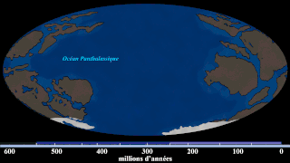
English: Hand-drawn images of the Earth around that timeframe. (Based on the first frame of the source GIF, which says this is 740 Ma. But i re-estimate this into around ~720 Ma based on the position of the continents with new Algol's video (at 9:20), which also has new and updated sources) With Algol's video and given that yellow stripe (that estimates the time) doesn't give when it is happening, i gave this illustration with a new estimate. Since this is an estimate, the exact time cannot be measured. Note: this is not a map of Rodinia, this is a map when Rodinia is breaking up at 720 Ma. |
| Дата | |
| Источник | File:Continental Drift (740 million-to-Today).gif |
| Автор | SebM123 |
.gif)
Лицензирование
| Этот файл доступен на условиях Creative Commons CC0 1.0 Универсальной передачи в общественное достояние (Universal Public Domain Dedication). | |
| Лица, связанные с работой над этим произведением, решили передать данное произведение в общественное достояние, отказавшись от всех прав на произведение по всему миру в рамках закона об авторских правах (а также связанных и смежных прав), в той степени, которую допускает закон. Вы можете копировать, изменять, распространять, исполнять данное произведение в любых целях, в том числе в коммерческих, без получения на это разрешения автора.
|
История файла
Нажмите на дату/время, чтобы посмотреть файл, который был загружен в тот момент.
| Дата/время | Миниатюра | Размеры | Участник | Примечание | |
|---|---|---|---|---|---|
| текущий | 04:35, 22 мая 2020 | | 1920 × 1080 (211 КБ) | MarioJump83 | Uploaded a work by SebM123 from File:Continental Drift (740 million-to-Today).gif with UploadWizard |
.gif)
Использование файла
Нет страниц, использующих этот файл.
Глобальное использование файла
Данный файл используется в следующих вики:
- Использование в fi.wikibooks.org
- Использование в pt.wikipedia.org
- Использование в tr.wikipedia.org
- Использование в www.wikidata.org