Файл:Plan of the Attack of Camaret Bay.jpg
Размер этого предпросмотра: 746 × 600 пкс. Другие разрешения: 299 × 240 пкс | 597 × 480 пкс | 956 × 768 пкс | 1274 × 1024 пкс | 2150 × 1728 пкс.
Исходный файл (2150 × 1728 пкс, размер файла: 1,97 МБ, MIME-тип: image/jpeg)
Этот файл находится на Викискладе. Сведения о нём показаны ниже.
Викисклад — централизованное хранилище для свободных файлов, используемых в проектах Викимедиа.
|
Краткое описание
| Описание |
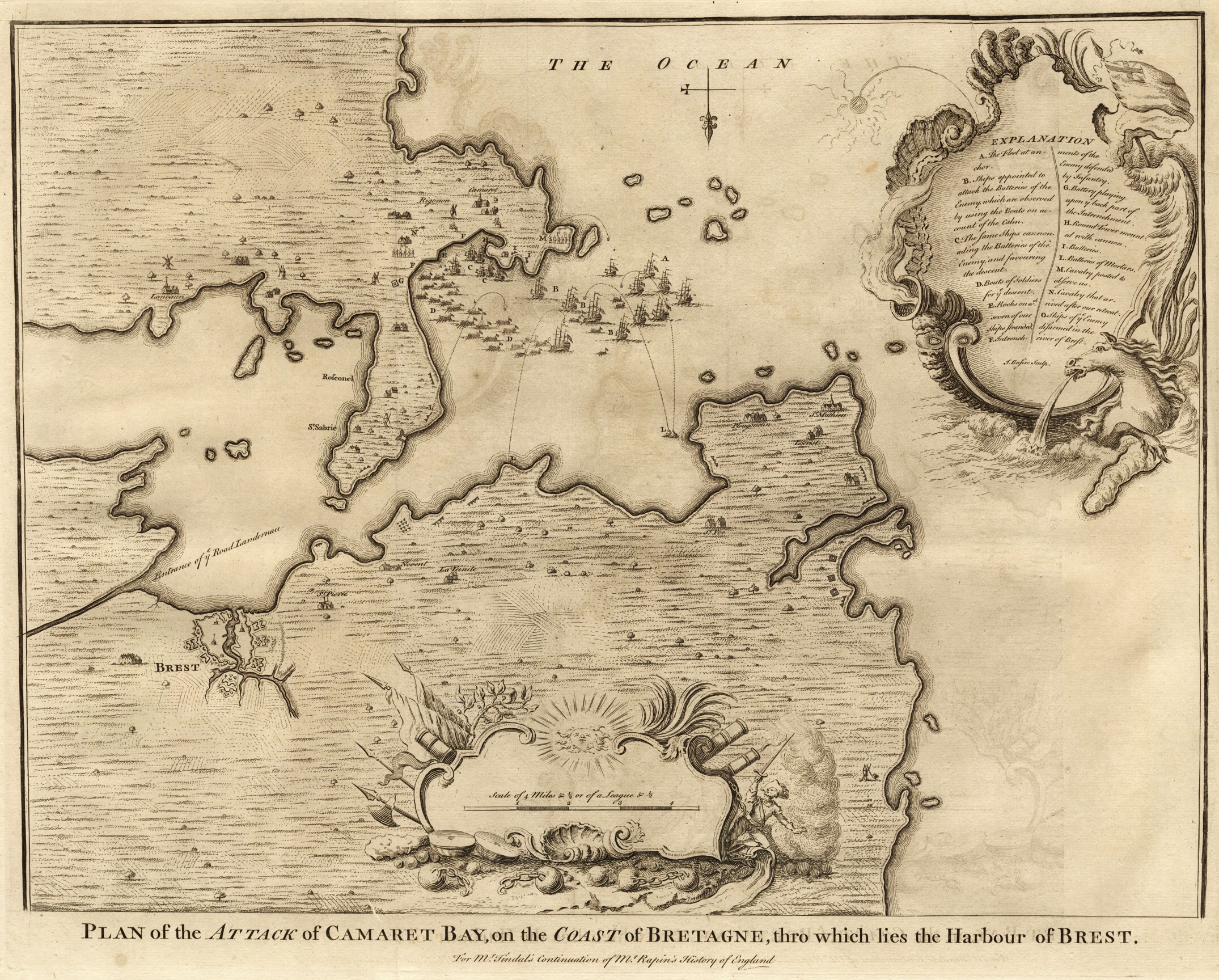
English: Plan of the Attack of Camaret Bay, on the Coast of Bretagne, thro which lies the Harbour of Brest.
For Mr. Tindal's continuation of Mr. Rapin's History of England Explanation:
Français : Plan de l'attaque dans la baie de Camaret, sur la côte de la Bretagne, où se trouve le port de Brest.
Deutsch: Angriffsplan der Bucht von Camaret, an der Küste der Bretagne, wo den Hafen von Brest liegt.
Español: Plan de batalla de la bahía de Camaret, en la costa de la Bretaña, donde se encuentra el puerto de Brest. |
| Дата | |
| Источник | own property |
| Автор | Basire, James [engraver] |
Лицензирование
|
Это произведение находится в общественном достоянии в тех странах, где срок охраны авторского права равен жизни автора плюс 100 лет и менее. | |
| Этот файл был определён как свободный от известных ограничений авторского права, а также связанных и смежных прав. | |
История файла
Нажмите на дату/время, чтобы посмотреть файл, который был загружен в тот момент.
| Дата/время | Миниатюра | Размеры | Участник | Примечание | |
|---|---|---|---|---|---|
| текущий | 21:42, 10 ноября 2008 | | 2150 × 1728 (1,97 МБ) | Mike bzh | {{Information |Description= |Source= |Date= |Author= |Permission= |other_versions= }} |
| 20:14, 4 ноября 2008 |  | 3015 × 2425 (3,02 МБ) | Mike bzh | {{Information |Description={{en|1=Plan of the Attack of Camaret Bay, on the Coast of Bretagne, thro which lies the Harbour of Brest.}} {{fr|1=Plan de l'attaque dans la baie de Camaret, sur la côte de la Bretagne, où se trouve le port de Brest.}} {{de|1= |
Использование файла
Следующая страница использует этот файл:
Глобальное использование файла
Данный файл используется в следующих вики:
- Использование в de.wikipedia.org
- Использование в en.wikipedia.org
- Использование в fr.wikipedia.org
- Использование в nn.wikipedia.org
- Использование в no.wikipedia.org
- Использование в www.wikidata.org
- Использование в zh.wikipedia.org