Файл:Southern Madeira.jpg

Размер этого предпросмотра: 800 × 513 пкс. Другие разрешения: 320 × 205 пкс | 640 × 411 пкс | 1024 × 657 пкс | 1280 × 821 пкс | 2560 × 1643 пкс | 3411 × 2189 пкс.
Исходный файл (3411 × 2189 пкс, размер файла: 1,11 Мб, MIME-тип: image/jpeg)
Этот файл находится на Викискладе. Сведения о нём показаны ниже.
Викисклад — централизованное хранилище для свободных файлов, используемых в проектах Викимедиа.
|
Краткое описание
| Описание |
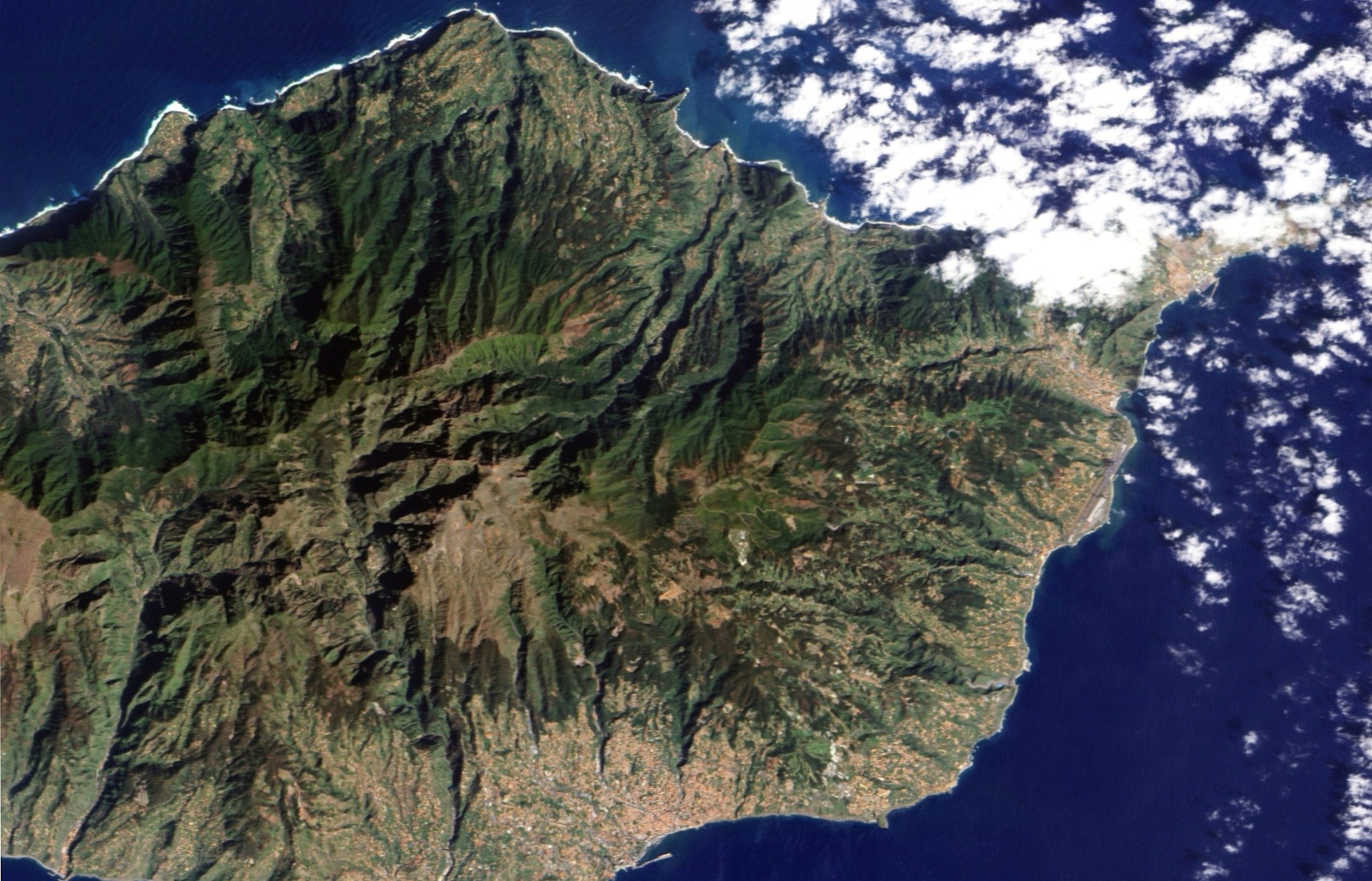
English: Two topographic features characterize this part of the Madeiran landscape: steep mountains and deep ravines. Both landforms are evident in this image. Deep ravines define the path water routinely takes off the island. In shadow in the morning sunlight, the ravines are like dark wrinkles radiating from the centre of the island in this image. The cities, the colour of terracotta roof tiles, are built mostly around the ravines in this region with two notable exceptions. The small town of Ribeira Brava sits at the mouth of a large ravine that extends from the heart of the island. The second exception is Funchal, the island’s capital. Three rivers run from the mountains into the city. The deep ravines that bring two of the rivers into the city are evident in the image. The rivers are lined with some of the city’s primary roads, and they come together in a “v” near the harbour. |
| Дата | |
| Источник | NASA Earth Observatory |
| Автор | Jesse Allen |
| Другие версии |
|

This image was taken by the Advanced Land Imager on NASA’s EO-1 satellite. EO-1 ALI data provided by the NASA EO-1 team.
Лицензирование
| Этот файл находится в общественном достоянии (англ. public domain), так как он был создан NASA (Национальным управлением по аэронавтике и исследованию космического пространства). Политика авторского права NASA гласит, что «Материал NASA не защищается авторским правом, если не указано иное». (См. Template:PD-USGov, страницу политики авторского права NASA или политику использования изображений JPL.) | ||
 |
Предупреждения:
|
| Аннотации | Это изображение аннотировано: Просмотреть аннотации на Викискладе |
История файла
Нажмите на дату/время, чтобы посмотреть файл, который был загружен в тот момент.
| Дата/время | Миниатюра | Размеры | Участник | Примечание | |
|---|---|---|---|---|---|
| текущий | 00:14, 17 августа 2012 | | 3411 × 2189 (1,11 Мб) | DarwIn | Reverted to version as of 14:02, 24 February 2010 |
| 00:13, 17 августа 2012 |  | 3999 × 2999 (4,56 Мб) | DarwIn | Higher res from same source | |
| 14:02, 24 февраля 2010 |  | 3411 × 2189 (1,11 Мб) | Originalwana | {{Information |Description={{en|1=Two topographic features characterize this part of the Madeiran landscape: steep mountains and deep ravines. Both landforms are evident in this image. Deep ravines define the path water routinely takes of |
Использование файла
Следующая страница использует этот файл:
Глобальное использование файла
Данный файл используется в следующих вики: