Файл:Spanish-virgin-islands.jpg
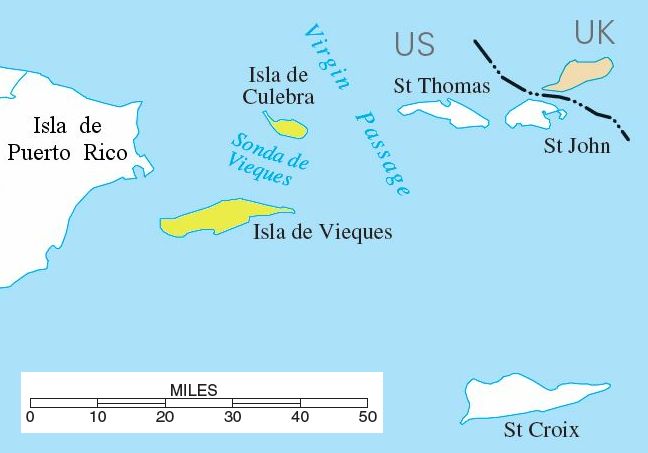
Spanish-virgin-islands.jpg (648 × 453 пкс, размер файла: 30 Кб, MIME-тип: image/jpeg)
История файла
Нажмите на дату/время, чтобы посмотреть файл, который был загружен в тот момент.
| Дата/время | Миниатюра | Размеры | Участник | Примечание | |
|---|---|---|---|---|---|
| текущий | 13:39, 10 августа 2006 |  | 648 × 453 (30 Кб) | Eoghanacht | {{Information |Description= {{w|Spanish Virgin Islands}} with surrounding islands. {{coor dm|18|18|51|N|65|18|W|}}. |Source= National Atlas of the United States[http://nationalatlas.gov/printable/images/pdf/rivers/pagehyd_pr4.pdf] |Date= |Author= |Permiss |
Использование файла
Следующая страница использует этот файл:
Глобальное использование файла
Данный файл используется в следующих вики:
- Использование в ar.wikipedia.org
- Использование в br.wikipedia.org
- Использование в da.wikipedia.org
- Использование в en.wikipedia.org
- Использование в eo.wikipedia.org
- Использование в es.wikipedia.org
- Использование в fa.wikipedia.org
- Использование в fr.wikipedia.org
- Использование в hr.wikipedia.org
- Использование в it.wikipedia.org
- Использование в ja.wikipedia.org
- Использование в ko.wikipedia.org
- Использование в lb.wikipedia.org
- Использование в nl.wikipedia.org
- Использование в no.wikipedia.org
- Использование в pnb.wikipedia.org
- Использование в pt.wikipedia.org
- Использование в ro.wikipedia.org
- Использование в ta.wikipedia.org
- Использование в uk.wikipedia.org
- Использование в ur.wikipedia.org
- Использование в www.wikidata.org
- Использование в zh.wikipedia.org


