Файл:Un-rwanda.png

Исходный файл (3038 × 2258 пкс, размер файла: 1,43 Мб, MIME-тип: image/png)
Этот файл находится на Викискладе. Сведения о нём показаны ниже.
Викисклад — централизованное хранилище для свободных файлов, используемых в проектах Викимедиа.
|
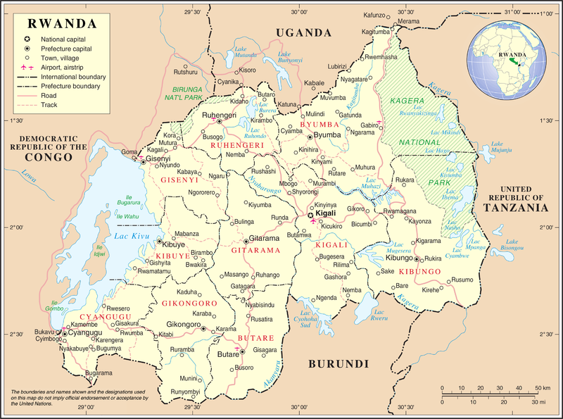
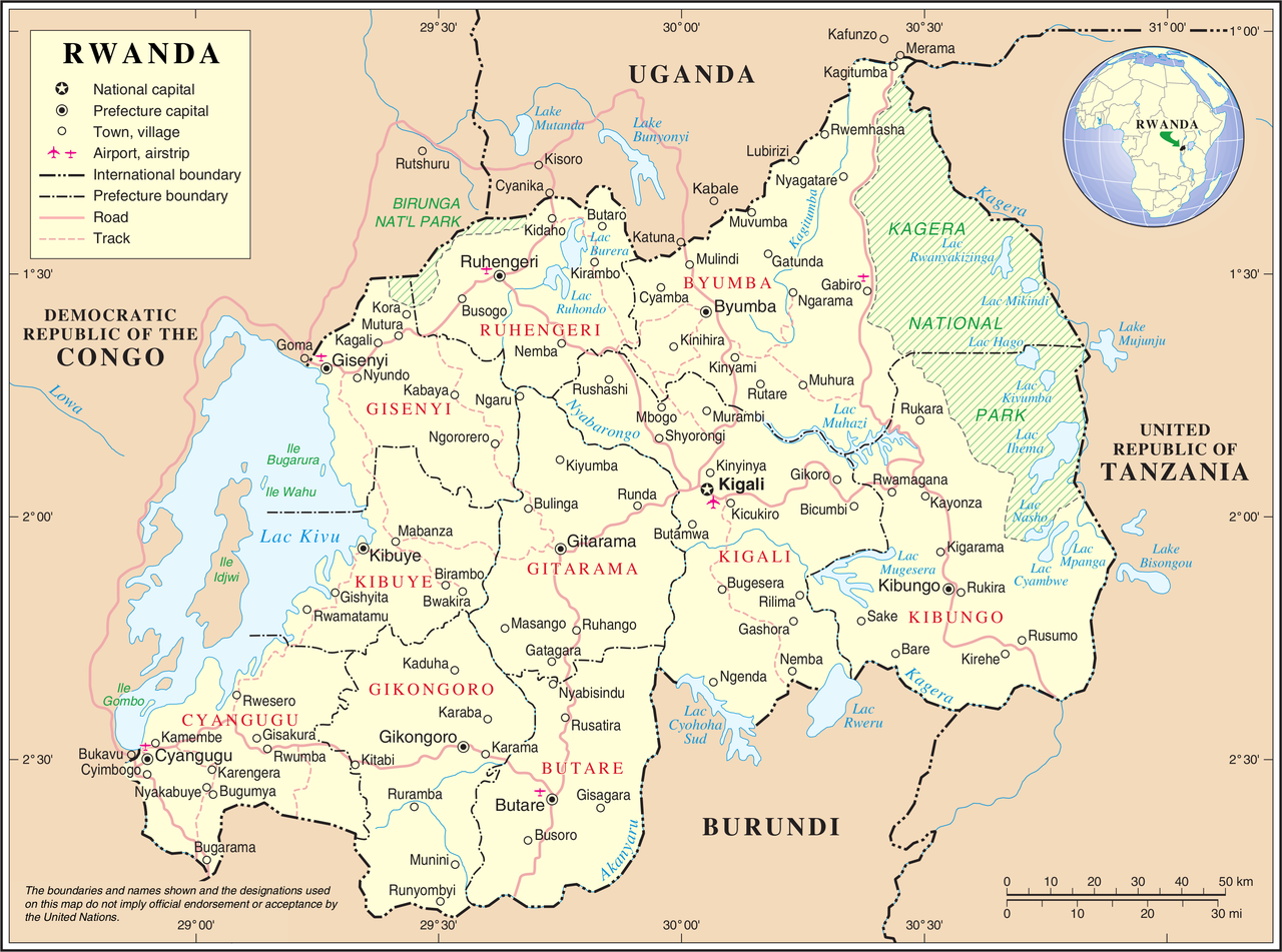
| Описание | United Nations Map showing Rwanda prior to the reform of its subdivision in 2006 | |||
| Источник | ||||
| Автор | United Nations Cartographic Section | |||
| Права (Повторное использование этого файла) |
|

История файла
Нажмите на дату/время, чтобы посмотреть файл, который был загружен в тот момент.
| Дата/время | Миниатюра | Размеры | Участник | Примечание | |
|---|---|---|---|---|---|
| текущий | 02:11, 24 октября 2007 | | 3038 × 2258 (1,43 Мб) | Jeroen | {{UN map}} Category:Maps of Rwanda |
Использование файла
Следующие 2 страницы используют этот файл:
Глобальное использование файла
Данный файл используется в следующих вики:
- Использование в avk.wikipedia.org
- Использование в ca.wikipedia.org
- Использование в ckb.wikipedia.org
- Использование в en.wikipedia.org
- Использование в fa.wikipedia.org
- Использование в fr.wikipedia.org
- Использование в id.wikipedia.org
- Использование в ja.wikipedia.org
- Использование в mg.wikipedia.org
- Использование в mzn.wikipedia.org
- Использование в nl.wikipedia.org
- Использование в no.wikipedia.org
- Использование в pl.wiktionary.org
- Использование в rw.wikipedia.org
- Использование в uk.wikipedia.org
- Использование в wa.wikipedia.org
- Использование в www.wikidata.org